In a hurry? Here is how to find property boundaries in NZ
- Start with the Record of Title and the relevant cadastral survey plan – they are the legal starting point, not the fence line.
- Use online maps and council GIS as broad guides only. They are useful context, but not legal proof of the boundary on the ground.
- Boundary pegs or other boundary marks may be buried, missing, disturbed or hard to identify without survey evidence.
- If accuracy matters for building, fencing, buying, subdividing or a neighbour dispute, engage a Licensed Cadastral Surveyor.
- Check easements, rights of way, covenants and other title interests as well as the boundary location itself.
- The earlier you confirm a boundary issue, the lower the risk of rework, delays or avoidable legal tension later.
How Do You Find Out Your Property Boundaries?
Understanding how and where to find your property boundaries is essential before any meaningful work begins on a site. Whether you are a homeowner, buyer, developer, architect or builder, boundary position influences design, legal risk, buildability and the path through approvals.
This is one of the areas where assumptions can become expensive. Old fences, neighbour advice, council maps and visible occupation can all be helpful clues, but they do not necessarily reflect the true legal boundary. If you get the boundary wrong, the consequences can include redesign, neighbour disputes, non-compliant building work, delayed resource consents or costly remedial work after construction has started.
奇异果视觉 land surveyors regularly help clients confirm property boundaries to support Resource consents, design decisions, fencing, due diligence and subdivision work. The goal is not just to point at a line on a plan. It is to give you clarity you can actually use.
What property boundaries actually are
A property boundary defines the legal extent of ownership. In New Zealand, ownership and registered interests are evidenced by the Record of Title, while the related cadastral survey plan records the surveyed legal boundaries, dimensions and references for the land.
That does not mean the line is always obvious on the ground. The on-site position of a boundary may need to be interpreted from survey records, existing marks, measurements, occupation evidence and other relevant information. That is why a legal boundary and a visible fence line are not always the same thing.
In practical terms, when accuracy matters, the question is not only “what does the title say?” but also “how does that legal boundary sit on the site today?”

Which source tells you what? A quick guide
| Source or clue | Useful for | What it does not prove on its own |
|---|---|---|
| Record of Title | Ownership, legal description, easements, covenants and other registered interests. | The exact current boundary position on the ground. |
| Cadastral survey plan | Boundary dimensions, survey references, angles and the legal survey framework for the lot. | Whether visible site features still align with the legal boundary today. |
| Boundary pegs or marks | A possible on-site indicator of a boundary point or change in direction. | That the mark is still correct, undisturbed, official or legally sufficient for your purpose. |
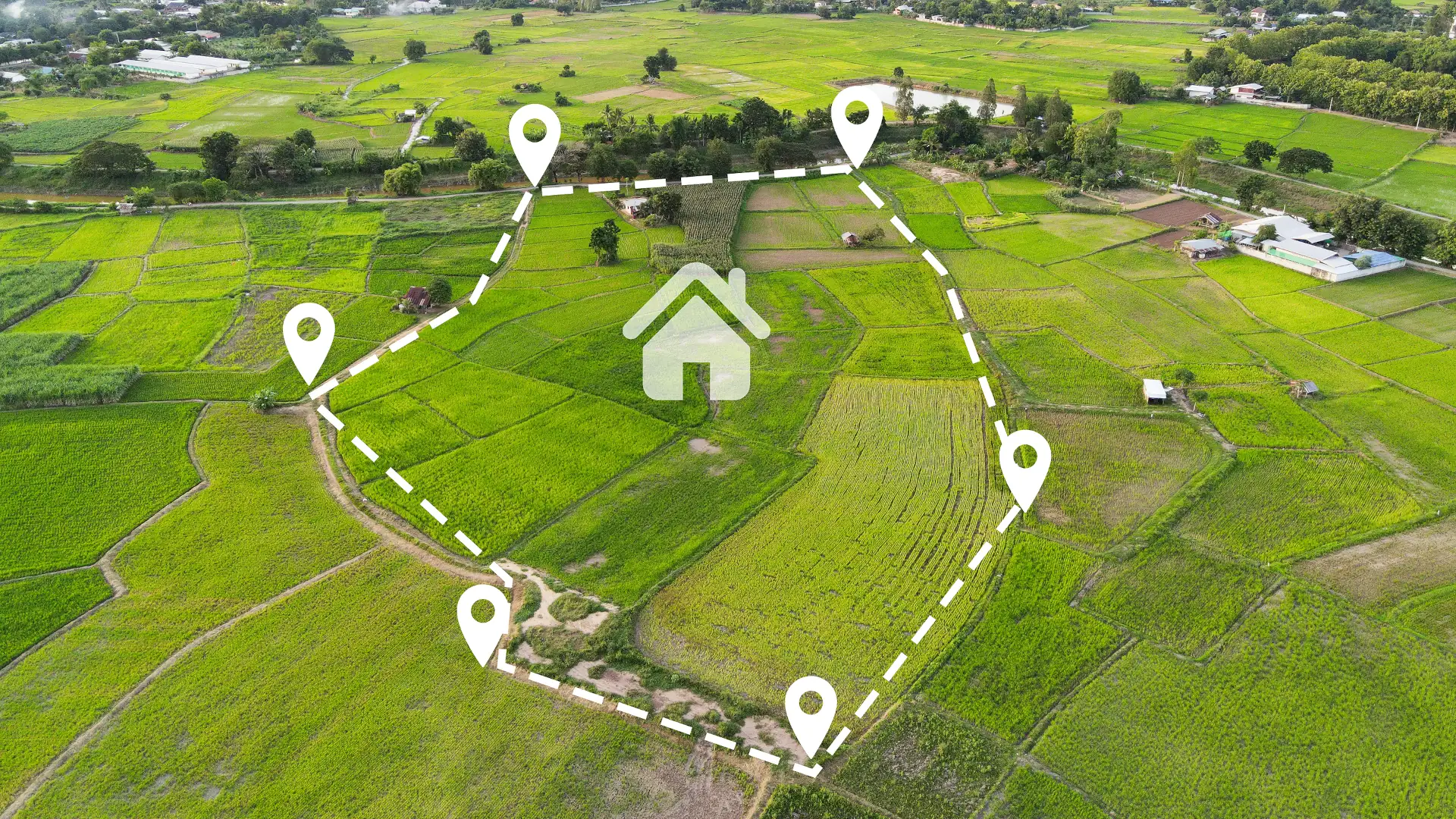
| Council GIS or online maps | Fast preliminary context for orientation, planning and feasibility checks. | Survey-level accuracy or legal proof for building, fencing or dispute resolution. |
| Licensed Cadastral Surveyor | Formal boundary identification, reinstatement, legal interpretation and site-based confirmation. | Not applicable - this is the route to rely on when the boundary actually matters. |
Four practical ways to find out your property boundaries
1. Review the Record of Title and survey plan
The first step is documentary. Review the current Record of Title and the relevant cadastral survey plan for the property. Together, these records can show the legal description of the land, boundary dimensions and survey references, and any easements, rights of way, covenants or other interests that may affect how the land can be used.
This is a strong starting point, but it is still a desk-based view. If the boundary needs to be physically identified on site, the title and survey plan usually need to be interpreted against current site conditions and survey evidence.
2. Look for boundary pegs or other boundary marks
Some properties still have visible boundary pegs or other boundary marks, but they are not always easy to find and they are not always straightforward to interpret. Marks can be buried, removed during earthworks, hidden by landscaping, or confused with unofficial pegs, fence posts or construction markers.
A visible peg can be a useful clue. It is not automatically legal proof on its own. Where a boundary point matters for construction, fencing or a dispute, the mark still needs to be assessed against the survey evidence.
3. Use online maps and council GIS as a preliminary check only
Online mapping tools and council GIS layers can be helpful for early orientation. They can assist with broad feasibility thinking, site familiarisation and early conversations about likely constraints.
They should not be treated as a substitute for a legal boundary survey. Mapping layers can be offset, simplified or based on data that is not intended to prove boundary position with survey-level precision.
4. Engage a Licensed Cadastral Surveyor
When the boundary matters legally or commercially, a Licensed Cadastral Surveyor is the correct pathway. This is the level of input you should rely on before building close to a boundary, installing a fence or retaining wall, subdividing, resolving a neighbour dispute, or carrying out due diligence on a site with unclear occupation.
A proper boundary survey can locate existing marks, re-establish boundary positions where needed, confirm alignment with survey data and provide reliable set-out information for site works.
When confirming boundaries becomes critical
- Before building near a boundary or relying on setback distances
- Before installing fences, retaining walls, driveways or services close to a boundary line
- Before subdividing land or lodging a development-related application
- During due diligence when buying a property with unclear occupation or unusual title issues
- If there is a dispute or uncertainty with neighbours about encroachments or use rights
- When a boundary issue could affect design, programme, cost or long-term asset value
Four common mistakes that cause delay and cost
1. Assuming fences mark the legal boundary
Fences are often installed for convenience, privacy or practicality. They can sit inside a boundary, outside it, or drift from the original line over time. Treat fencing as occupation evidence, not definitive proof.
2. Trusting outdated or incomplete information
Historic plans, neighbour recollections and old sketches may be useful context, but they may not reflect the current legal position or today’s site conditions.
3. Starting works before the boundary issue is resolved
Beginning construction, fencing or retaining based on assumptions can trigger remediation, redesign, neighbour conflict or compliance problems later.
4. Ignoring easements, rights and encumbrances
Even when the boundary location is correct, easements, covenants, consent notices or access rights may still restrict what can be built or where work can occur.
What you typically receive from Kiwi Vision
When confirming property boundaries, clarity and accuracy need to lead to action, not just information. Depending on the scope, Kiwi Vision boundary work typically includes:
- Title and survey-record research relevant to the site and the issue being investigated.
- Field measurements and site inspection to assess existing marks, occupation and practical constraints.
- Boundary identification or boundary reinstatement work where required for the purpose of the job.
- Pegs, marks or on-site set-out information where that is appropriate to the agreed scope.
- A survey plan, sketch or formal report suitable for the decision that needs to be made.
- Where the work involves legal cadastral or title-change requirements, the appropriate cadastral dataset and supporting documentation.
- Clear notes on scope, assumptions and next steps, so you understand what is confirmed and what still needs separate action.
Some projects also benefit from related topographic, planning or development support, especially where the boundary issue sits inside a wider project pathway.
The fastest way to scope your boundary survey
If you are unsure where your boundaries sit, or whether you need a formal survey, the quickest way to get clarity is to start with a short feasibility review. Send Kiwi Vision:
- Your property address or title reference
- Any Record of Title, survey plan, LIM, GIS printout or other documents you already have
- A simple note on what you want to do – fencing, building, retaining, buying, selling, subdividing or resolving a dispute
- Any photos, sketches or marked-up plans that show the area of concern
- Your timing and project driver, especially if approvals, contractors or settlement dates are involved
With that information, Kiwi Vision can usually confirm whether a boundary identification survey is likely to be required, what risks or constraints should be addressed early, and the likely timeframe and cost range for the next step.
FAQs
How do I find my property boundaries in New Zealand?
Start with the Record of Title and the relevant cadastral survey plan. If the boundary needs to be relied on for building, fencing, buying, subdividing or a dispute, engage a Licensed Cadastral Surveyor to confirm the boundary on the ground.
Are fences a reliable indicator of property boundaries?
No. Fences can be useful clues, but they are not reliable proof of the legal boundary on their own.
Can I rely on council GIS or online boundary maps?
Use them as preliminary reference tools only. They are useful for orientation and feasibility, but they are not a substitute for a legal boundary survey when accuracy matters.
What if the boundary pegs are missing?
Missing or buried marks do not mean the boundary cannot be found. A Licensed Cadastral Surveyor can assess the survey evidence and, where appropriate, re-establish the boundary position.
Do I need a survey before building a fence or retaining wall?
If the work is close to the boundary, yes – or at least get early advice. It is far cheaper to confirm the boundary before work starts than to correct a problem afterward.
Can Kiwi Vision help with more than just the boundary?
Yes. Kiwi Vision can also help with wider project needs such as topographic surveys, resource consents, subdivision support and development coordination where the boundary question forms part of a larger job.
Find your exact property boundaries with Kiwi Vision
If you are planning a development, buying a site, installing boundary-related works or simply need clarity before making a decision, 奇异果愿景 can help you confirm boundary positions and align them with your next step.
The earlier the boundary issue is resolved, the more certainty you have around design, approvals, buildability and cost.
- Need a boundary identification or survey? Request a quote with your site details.
- Not sure where your boundaries sit? Book a short scoping call and we will advise on the right approach.
- Running a development? Ask about integrated surveying and subdivision support from feasibility through to title issue.
