You can put months (or years) into a build, then lose momentum right at the finish line because the final documentation does not match what was consented, or because council needs clearer evidence before sign-off. An as-built survey removes the guesswork by recording what has actually been constructed on site – accurately, consistently, and in a format that can be used for compliance and future records.
This guide explains what an as-built survey is, when you typically need one, and how it protects programme, compliance and value. Kiwi Vision supports residential and development projects across Auckland, Hamilton, Tauranga and the wider Waikato, Bay of Plenty and King Country/Waitomo districts.
In a hurry? Here is the short answer:
In a hurry? Here is what most people mean by an as-built survey:
- What it is: a precise survey that measures and maps completed works (buildings, levels and key features) as they exist on site.
- Why it matters: it provides evidence for council sign-off, reduces disputes, and creates an auditable record for future renovations or sales.
- When you need it: often before Code Compliance Certificate (CCC), and commonly for land development records (for example, subdivisions and services).
- What you receive: an as-built plan (typically PDF, and CAD if required) showing key dimensions, offsets and levels relevant to the scope.
- Fastest way to scope it: send your site address, the latest consented plans, and the consent conditions – we can confirm what needs to be measured and when.
Requirements depend on your consent conditions.
What Is an As-Built Survey?
An as-built survey is a factual measurement of a site after construction. It records what is actually there – the true position, size and level of built elements – rather than what was intended on design drawings.
This matters because council sign-off, future development, and even property transactions rely on clear, defensible records. If the finished build differs from the consented plans (even by small amounts), the right documentation helps identify the issue early and clarify the path forward.
A few terms that often get mixed up:
- As-built survey – measures what has been constructed and produces an as-built plan/report.
- Setout (stakeout) – marks the design on the ground before or during construction so builders place works correctly.
- Boundary (cadastral) survey – confirms legal boundary position where required. An as-built survey uses boundary information, but it is not a substitute for boundary definition.
When Do You Need an As-Built Survey?
The short answer is: when a consent condition, council process, lender, or future owner needs proof of what was built. Timing and scope vary by project and by consent conditions, but these are the most common triggers:
- Before council sign-off (often CCC): many builds require evidence that the building location, setbacks, and levels match the consented design. Always check your consent conditions.
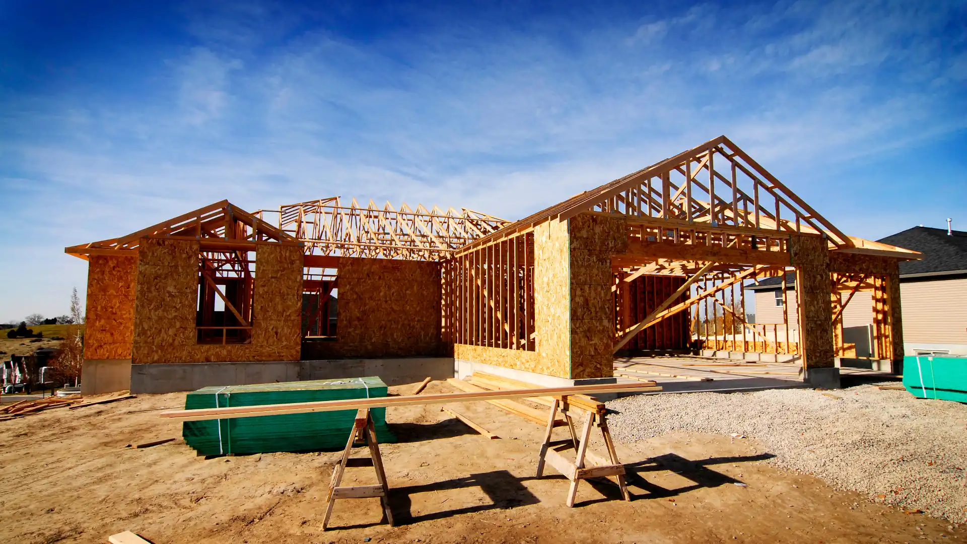
- After major building work: new builds, additions, retaining walls, driveways and other permanent structures may need to be documented for records and compliance.
- For subdivisions and multi-lot developments: councils and asset owners often require as-built information for completed services and infrastructure before titles and approvals can be finalised.
- Before selling or refinancing: an as-built plan can reduce buyer questions and support clearer due diligence, especially where boundary proximity or service information is important.
- Before future renovation or extension: knowing where services and structures are located avoids redesign and rework later.
Typical Timing (a practical guide)
Use this quick guide to match the survey inputs to each project stage (exact requirements vary by site conditions, council processes and contract scope):

What Does an As-Built Survey Usually Include?
The exact scope should match the consent conditions and what council needs to see. In most residential and small-to-medium development projects, an as-built survey may include:
- Building footprint and key dimensions, including offsets to boundaries where relevant.
- Finished floor levels and critical levels where required.
- Retaining walls, driveways, fences and other permanent structures within scope.
- Service features (for example, water, wastewater and stormwater). Scope depends on access and what information is available.
- A plan suitable for submission and record-keeping (PDF, and CAD/DWG if required).
Note: an as-built plan can be prepared from a mix of field measurements and project documentation. If you need legal boundary confirmation, that is a separate boundary (cadastral) process.
How Surveyors Perform As-Built Surveys
As-built work is a technical process. The goal is simple – accurate, repeatable measurements that stand up to scrutiny and reduce rework. Here is what typically happens:
1. Brief and scope (no surprises)
We review the latest consented plans, any relevant conditions, and previous survey data. This is where we confirm what needs to be checked (for example, building location, levels, or specific structures) so the output matches the real requirement.
2. Site measurement
On site, surveyors capture the required points using equipment such as GNSS (GPS), total stations, and where appropriate, laser scanning or drone capture. The level of accuracy depends on the scope, site conditions and the method used, but the objective is always to produce a defensible record.
3. Office processing and comparison
Measurements are processed and checked against the approved plans. If something is different (for example, a structure closer to a boundary than expected), you can address it while the project is still active – rather than finding out during final sign-off.
4. As-built plan and council-ready documentation
We produce an as-built plan that records the surveyed features clearly and consistently. Where required, this can be provided in a format suitable for council submission and long-term project files.
Common Issues an As-Built Survey Helps Resolve
An as-built survey is often the last checkpoint before sign-off. It is also where small issues become visible – while they are still fixable. Common examples include:
- Setback or location non-compliance: a structure built closer to a boundary or road than consented can trigger delays and rework.
- Boundary proximity or encroachment risk: where a fence, retaining wall or part of a structure sits unexpectedly close to (or over) a boundary, it can lead to disputes and hard conversations later.
- Service location mismatches: incorrect or unclear service positions make maintenance and future upgrades harder and can affect council records.
- Level discrepancies: finished floor levels and site levels matter for flooding, accessibility and performance.
- Documentation gaps: missing, inconsistent or non-standard records slow down handover, due diligence and future works.
How to Plan an As-Built Survey Into Your Programme
The biggest cause of sign-off delays is leaving the as-built survey until the very end, then discovering that information is missing or the scope was not aligned to the consent conditions. A better approach is:
- Book early: as soon as you have a programme, schedule the as-built survey window so it does not become a bottleneck.
- Confirm scope from the consent conditions: we can review these with you so you only pay for what is required, and you get what council actually needs.
- Keep plan revisions under control: provide the latest approved revision set so the comparison is clean and defensible.
- For developments: consider staged as-builts (for example services before final surfaces) to protect momentum.
What to Send Us to Get an Accurate Scope and Quote
To move quickly (and avoid back-and-forth), send the following:
- Site address and, if available, the legal description.
- Latest consented plans (architectural and site plans).
- Consent conditions (or the relevant pages that mention surveys/as-builts).
- Any available service plans or contractor as-built information.
- Your programme and the date you need the documentation by.
Why Work With Kiwi Vision?
Kiwi Vision is set up to support projects end-to-end – from early site and feasibility work, through consenting, setout and delivery support, to as-built documentation and close-out. Our focus is outcomes, not hours, with no surprises.
- Clear scope up front so you know what is required, when, and why.
- Council-ready documentation and practical support to keep momentum.
- Experience across residential, infill, multi-dwelling and subdivision projects.
- Coverage across Auckland, Hamilton, Tauranga and the wider Waikato, Bay of Plenty and King Country/Waitomo districts.
Next step: Email or call Kiwi Vision with your address, latest plans and consent conditions. We will confirm the as-built scope and timing, then provide a clear, council-ready deliverable that supports a smooth sign-off.
FAQs
Is an as-built survey the same as a building location certificate?
Not always. Different councils and consultants use different terms. In practice, both relate to documenting what was built and how it sits on the site. The exact scope depends on what the consent conditions require (for example setbacks, levels, or specific structures).
Will council always require an as-built survey for CCC?
Not always, but many projects need some form of as-built or location information for sign-off. The safest approach is to check the consent conditions early and confirm what documentation is required.
How long does an as-built survey take?
It depends on site access, complexity and what needs to be captured. If you want to avoid programme risk, book early and provide the latest approved drawings so the scope is clear from day one.
Can you do an as-built survey before the build is fully finished?
Often, yes. Many projects benefit from staged capture (for example once the footprint is final and key features are in place). The best timing depends on what council needs to see and which elements are critical.
Do I need a boundary survey as well?
Not always. An as-built survey measures what has been built. If legal boundary confirmation is required (for example for boundary adjustments or specific compliance matters), a boundary (cadastral) survey is a separate process.
What affects the cost of an as-built survey?
Main drivers include site size, access, the number of features to be captured, whether services information is required, and the required output format (for example PDF only vs PDF plus CAD).
Wrap Up Your Project Without the Guesswork
An as-built survey is the bridge between what was designed and what was actually delivered. Done properly, it protects programme at the finish line, supports council processes, and leaves you with records you can rely on for years.
If you are nearing completion or closing out a development, get in touch with Kiwi Vision. We will confirm the scope against your consent conditions and provide clear, defensible documentation to support a smooth sign-off.
