
In construction, millimetres and centimetres matter. A small setout error, a missed compliance check, or an incomplete as-built can trigger rework, programme delays, and hard conversations at sign-off. Construction surveying gives developers, builders and project managers confidence that what is on the plans ends up in the right place on the ground, and stays compliant from start to finish.
This guide explains the main types of surveys in construction, when you typically need each one, and what you should expect to receive. Kiwi Vision supports projects across Auckland, Hamilton, Tauranga and the wider Waikato, Bay of Plenty and King Country/Waitomo districts.
In a hurry? Here are the survey types most construction projects need:
Topographic (site) survey – contours, levels and key site features for design and due diligence.
Boundary / cadastral context – confirms legal boundaries when required (a topo survey alone is not a boundary survey).
Control survey – establishes reference points that all setout and as-builts tie back to.
Building setout (stakeout) – marks the exact location of buildings, retaining walls and key elements before construction.
Height to boundary checks – verifies compliance when building close to boundaries or under district plan controls.
Services setout and as-built – sets out and records drainage and underground services for coordination and council records.
As-built surveys – documents what was actually built for council sign-off and future works.
Monitoring surveys (where required) – tracks movement on sensitive sites or near existing assets.
What Is a Construction Survey?
A construction survey is a specialised branch of surveying focused on the practical needs of building and land development projects. The job is to translate a design into accurate, repeatable marks and measurements on site, and then verify (and document) what was built.
It helps to separate a few terms that get mixed together:
- Topographic (site) surveys map the land shape (contours and levels) and visible features for design.
- Boundary / cadastral work is what confirms legal property boundaries when required. A topo survey on its own does not prove boundary location.
- Construction surveying establishes control, sets out the design, checks compliance during the build, and produces as-built documentation for sign-off and records.
Why Do You Need Surveying in Construction?
Skipping proper surveying is like building on guesswork. The cost of getting it wrong is rarely limited to a few hours – it usually shows up as rework, delays, or compliance risk. Here is what good surveying protects:
- Accuracy & quality control: setout and verification prevent small errors becoming compounding problems.
- Programme certainty: survey checkpoints reduce late surprises that stall contractors or trigger redesign.
- Risk reduction: good site data highlights constraints early (levels, slopes, existing features). For ground conditions, geotechnical investigations are still essential.
- Council and consent compliance: councils often require evidence that works meet zoning rules and consent conditions (for example, height to boundary compliance or as-built information for services).
- Cost control: accurate quantities, fewer variations, and less rework protects your margin.
- Defensible records: survey outputs become a long-term reference for future works, property transactions, and resolving disputes.
On projects with tight constraints, good surveying is often the difference between smooth momentum and a stalled site. For example, at the Piha Surf Club project, surveying helped ensure the new facility sat within approved limits in a coastal environment where compliance and accuracy matter.
Which Survey Do I Need?
The best time to plan surveys is before you break ground. Use this quick guide to match survey types to each project stage (requirements vary by council and site conditions):
Key Types of Survey in Construction
Not every survey on a construction site does the same job. Some surveys create the base data for design, some set out the work, and others provide the evidence needed for council sign-off. The best outcomes come from planning survey inputs against your consent conditions and construction programme early.
Topographic (Site) Surveys
What it is: A detailed site survey that captures contours/levels and key visible features such as buildings, kerbs, fences, walls, trees and surface features. It forms the base layer for design and due diligence.
When you need it: Early design and feasibility, drainage and civil design, earthworks planning, and when you need accurate site information to de-risk cost and constructability.
What you receive: Typically, a plan (PDF) and CAD data (often DWG), and, where required, a digital terrain model/surface for design software.
Boundary / Cadastral Survey Context (When Required)
What it is: Boundary work confirms the legal position of property boundaries. It is different from a topo survey. Boundary definition can be critical when you are building close to a boundary, creating new titles, or working with easements and access lots.
When you need it: subdivisions, new boundary marks/pegs, developments close to boundaries, driveway access constraints, or where title issues need to be resolved early.
What you receive: scope varies, but may include boundary marks/pegs, a boundary plan, and supporting documentation for consenting or legal records.
Control Surveys
What it is: A control survey establishes reliable reference points (control marks) that all later setout and as-built work ties back to. Control is the backbone of accurate measurement on site.
When you need it: Before any major setout, for larger sites, multi-stage builds, subdivisions, or where multiple contractors will rely on consistent coordinates and levels.
What you receive: control marks on site and a control report/coordinates that can be shared with the project team.
Building Setout Surveys (Stakeout)
What it is: Setout is the translation of design into the ground. Surveyors mark the exact position of buildings, foundations, retaining walls, roads and key features using pegs, nails, offset marks and precise coordinates.
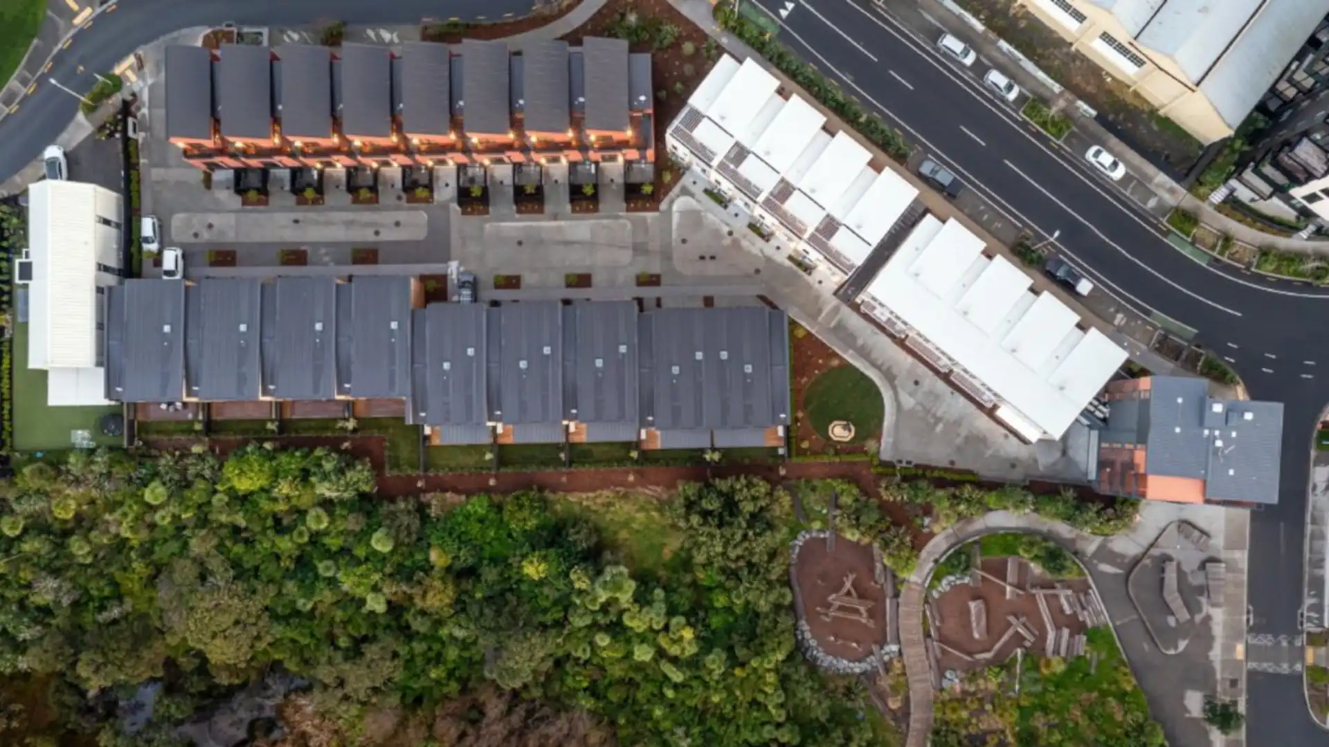
Why it matters: if the first elements go in the wrong place, everything that follows is compromised. Repositioning a structure is not just expensive – it can halt a project. On the Launch Bay subdivision in Hobsonville, Kiwi Vision setout work helped peg out 26 individual lots quickly and accurately, keeping the build aligned with consented plans.
Height to Boundary Surveys
What it is: Height to boundary checks verify that a building complies with district plan controls where height limits relate to boundary lines. This is particularly relevant when building close to boundaries.
When you need it: often at design/consent stage and again during construction (commonly once framing is up) to confirm the build remains within approved limits.
What you receive: a compliance check and supporting documentation suitable for council or project records (requirements vary by council and consent conditions).
Services Surveys (Setout and As-built)
What it is: Services surveying supports the setout and recording of drainage and underground services. It helps keep civil works coordinated and reduces risk of clashes during construction.
Important note: information about existing services often relies on utility records, on-site observations and (where required) dedicated service locating. Always confirm the level of certainty needed for excavation planning.
What you receive: setout marks for new works and as-built plans/schedules showing what was installed and where.
Earthworks and Volume Surveys (Common on Developments)
What it is: volume surveys measure cut and fill quantities and can support progress claims, mass haul planning, and earthworks verification on land development sites.
What you receive: volume calculations and reporting tied back to agreed surfaces and control.
Monitoring Surveys (Where Required)
What it is: monitoring surveys track movement over time. They are used on sensitive sites (for example, near slopes, retaining walls, deep excavations, or adjacent structures) to provide early warning and defensible records.
What you receive: a monitoring plan and periodic reporting that can be shared with engineers, councils and stakeholders where required.
As-built Surveys
What it is: an as-built survey records permanent features after construction (for example drainage, driveways, services and structures). Councils commonly require as-built information to support sign-off and update asset records.
At Snowplanet, Kiwi Vision as-built surveys documented drainage and service connections to support council sign-off and provide a reliable reference for future maintenance.
What you receive: as-built plans (often PDF and CAD) and, where required, schedules formatted to council requirements.
Rentable Area Surveys (Commercial)
What it is: rentable area surveys measure internal floor areas for leasing and asset management. The key is consistency – measurement rules are often specified in the lease or the client brief.
What you receive: an accurate floor plan with verified area calculations suitable for agreements, reporting and decision-making.
How Surveys Fit Into End-to-End Development Support
For developers, the goal is not a survey for the sake of it – the goal is a project that is ready to consent, ready to build, and ready to sign off without avoidable surprises. Good survey planning connects directly to feasibility, planning, civil design and construction sequencing.
Kiwi Vision supports end-to-end development outcomes by combining surveying with broader land development support, including planning and consenting advice and land development engineering design (scope dependent). The advantage is simple: fewer gaps between disciplines and a clearer path through council requirements.
Common Survey Mistakes That Cost Time and Money
- Designing off outdated or incomplete site data (leading to late redesign).
- Starting setout without a solid control network (errors compound quickly).
- Leaving height to boundary checks until framing, then discovering compliance issues late.
- Capturing as-built information too late, after services are covered or access is lost.
- Not aligning deliverables with council submission requirements (avoidable resubmissions).
What to Send for a Fast, Accurate Survey Scope
If you want a fast, accurate scope (and fewer back-and-forths), send the following up front:
- Site address and, if available, legal description (Lot/DP).
- Latest architectural and civil drawings (PDF and CAD if available).
- Consent conditions or council requirements (if consent is already granted).
- Project programme: when you need setout, checks and as-builts.
- Site constraints: access, existing structures, retaining, coastal or geotechnical considerations.
Next step: If you are not sure which surveys your project needs, send your plans and consent conditions and we will map the survey package against your build programme. Outcomes, not hours. No surprises.
FAQs
Do I need a survey before I apply for consent?
Often, yes. A topographic (site) survey is commonly used to support design and consenting. If your project is close to boundaries, you may also need boundary context early. Requirements vary by site and council.
What is the difference between a topographic survey and a construction setout?
A topographic survey captures existing conditions for design (contours and features). A construction setout takes the approved design and marks it on the ground so the contractor can build in the correct location and level.
When is a height to boundary survey required?
It is commonly needed when building close to boundaries or where district plan controls apply. Many projects check at design stage and again during construction (often at framing) to confirm compliance.
What do councils usually want for as-built sign-off?
It depends on the consent and the type of works, but councils often require as-built plans and/or schedules for drainage and services, and sometimes key structural or access features. We align the deliverables to the consent conditions to reduce resubmissions.
What affects the cost and timing of a construction survey?
Site access, terrain, complexity, required accuracy, project size, and how well information is provided up front. Clear plans, a stable programme and early scoping usually reduce cost and delay.
Can Kiwi Vision support the wider development process, not just surveys?
Yes. For many projects we support end-to-end development outcomes by combining surveying with planning and consenting support and land development engineering design (scope dependent), helping you keep momentum from feasibility through to sign-off.
Wrapping It Up Without the Guesswork
Construction projects succeed or fail on precision and defensibility. The right survey, at the right time, protects programme, cost and compliance. If you are planning a build or managing a development in Auckland, Waikato, Bay of Plenty or the King Country/Waitomo districts, Kiwi Vision can help you scope the right survey package and support you through to sign-off.
- Need setout or as-builts? Request a quote with your latest plans and programme.
- Not sure what you need? Book a short scoping call and we will confirm what surveys are required and when.
- Running a development? Ask about end-to-end development support across surveying, planning and delivery coordination.
