
Understanding how to read a land survey report might seem daunting at first, especially when faced with technical terms and unfamiliar symbols. But with a little guidance, it’s easier than you think. A land survey report is an essential tool for buying, selling, or developing property. In this guide, we’ll walk you through what to expect, explain key terms, and show you how to use the report to make confident property decisions.
What to Expect in a Land Survey Report
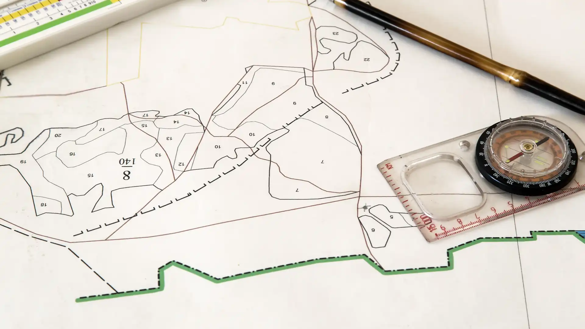
A land survey report is essentially a blueprint of your property, highlighting its boundaries, features, and legal details. It’s designed to eliminate any guesswork about your land and is instrumental to the construction process. Here’s what it typically includes:
- Property Boundaries: These are the bread and butter of a survey report. They mark the exact edges of your property using precise measurements and reference points.
- Topographical Details: Elevations, slopes, and land features–useful for construction or landscaping projects–are captured here.
- Easements and Rights of Way: This section highlights where other parties (like utility companies) can access your land.
- Improvements: Includes information on structures like buildings, fences, or driveways within the property boundaries.
- Encroachments: These highlight structures that cross into neighbouring properties, sometimes leading to disputes.
- Legal Descriptions: The official wording that legally defines your property, often tied to cadastral records, is an important part of a land survey report.
A well-done land survey report provides a crystal-clear snapshot of your property, giving you the information you need to move forward confidently.
Understanding Key Terms and Symbols in the Report
Survey reports often include technical terms and symbols that can seem like another language. Don’t worry–we’re here to decode them for you! Here are some common ones:
- Benchmark (BM): A fixed point with a known elevation that serves as a reference.
- Contour Lines: These wavy lines show elevation changes. Close lines mean steep slopes, while wider gaps mean flatter areas.
- Easements: Marked by dashed lines, easements identify areas where others have limited access or usage rights.
- Metes and Bounds: A detailed way of describing property lines using distances and directions.
- Right of Way (ROW): Often shown with dotted lines, these are areas where people or utilities have the right to pass through.
- Flood Zones: Areas prone to flooding, usually shaded or marked with specific symbols.
- Datum: A reference point or level used to measure elevations.
- Setbacks: The required distance between structures and property boundaries, often dictated by zoning laws, is called a setback.
- Monuments: Physical markers (like metal rods or stones) placed to define key boundary points are monuments.
- Deed Lines: Legal property boundaries as described in your deed.
Your survey report will also include a legend to help you decode all the symbols and abbreviations. Spending a few minutes with it can make a big difference!
Common Mistakes to Avoid When Using a Survey Report
Mistakes can happen even if you understand what a survey report says. Here’s what to watch out for:
- Overlooking Easements: Building on or near an easement can lead to legal complications.
- Misinterpreting Contour Lines: Incorrectly reading elevation changes might lead to drainage or structural issues.
- Not Verifying Boundaries: Always make sure the boundaries match your expectations and plans.
- Using Outdated Reports: Property features change, so check that your report is the latest one.
- Skipping Professional Help: If you’re uncertain about any details, consult a surveyor or property expert.
How to Use the Survey Report for Property Decisions
Your land survey report is a powerful tool that will help guide any property-related decisions you have to make. For buyers, it’s used to verify boundary lines and ensure that land features align with exactly what is being offered. For sellers, the report will help instil confidence in potential buyers that the picture you’ve painted of the property is accurate.
If you’re planning a construction or development project, a land survey’s topographical details are essential for the planning stages, giving designers a clear view of the landscape.
In cases where boundary disagreements or encroachments arise, the survey report serves as a source of truth to resolve disputes fairly. The same goes for zoning laws and permits; having this report ensures that plans comply with local regulations before you break any ground.
With a solid understanding of your survey report, you’ll make informed and confident decisions, minimising potential headaches and costly mistakes in the future.
Making Sense of Your Land Survey Report
Reading a land survey report doesn’t have to be a nerve-wracking experience. With a little knowledge and the right support, you can confidently interpret one.
At Kiwi Vision, we’re here to make the process simple and efficient, offering expert insights and reliable survey solutions for every property need. Contact us today if your project needs a thorough land survey report.
