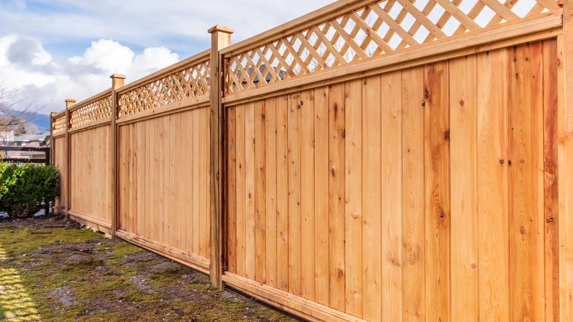
Think your fence marks the edge of your property? Think again. Property boundaries aren’t always as clear as they seem, and a misplaced fence, driveway, or structure could land you in a costly dispute. Residential boundary surveys help homeowners know exactly where their land begins and ends.
In this guide, we’ll explain why boundary surveys are essential, how they work, and when they can help prevent common property disputes. Whether you’re a homeowner or developer or just want peace of mind about your land, understanding boundary surveys is key to protecting your property rights.
Why Boundary Surveys Are Critical for Property Owners
Whether planning a new fence, subdividing land, or settling a dispute with a neighbour, knowing exactly where your property begins and ends can save you a lot of stress and money. That’s why many homeowners, developers, and legal professionals rely on surveyors to provide clarity and prevent potential problems.
In New Zealand, boundary surveys follow strict cadastral survey guidelines set by Land Information New Zealand (LINZ). These rules ensure that property lines are recorded accurately, reducing disputes and making sure developments stay within legal boundaries. In many cases, a boundary survey is also required as part of the resource consent process to ensure compliance with local council regulations.
Key Steps in Conducting a Boundary Survey
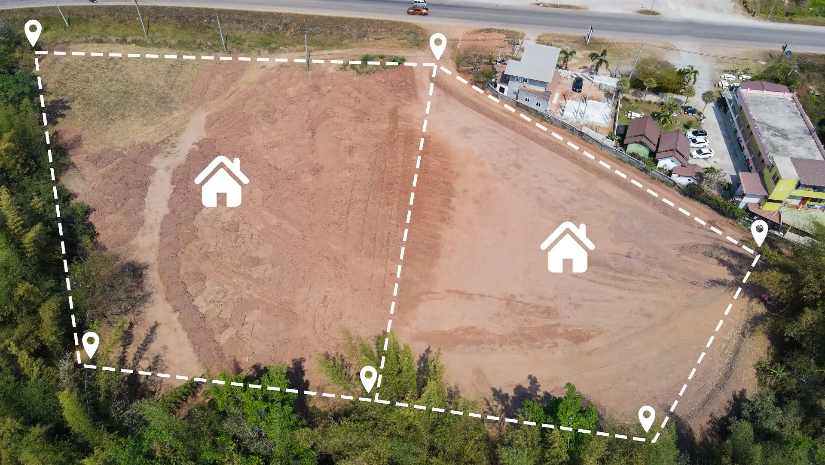
Property lines aren’t always as simple as a fence or a hedge. Sometimes, the actual legal boundary is a few centimetres (or even metres) off from what you see on the ground. That’s where surveyors come in, using historical records, modern technology, and legal expertise to pinpoint the true property lines.
A residential boundary survey isn’t just about measuring land – it’s a precise, multi-step process that ensures property lines are legally and accurately defined. Here’s what happens:
1. Initial Research and Land Records Review
Before going on-site, surveyors gather key documents such as land titles, historical survey plans, and subdivision records from LINZ. These records provide essential background on the property’s legal boundaries, past disputes, and potential inconsistencies in historical data.
2. On-Site Measurement and Data Collection
Using high-precision tools like GPS, total stations, and laser scanners, surveyors take detailed measurements of the land. This step ensures that existing fences, buildings, and physical features align with the legal boundary records.
3. Analysing and Reconciling Data
Once the measurements are collected, surveyors compare them with historical records. Sometimes, discrepancies arise. Fences might not be where they should be, or old survey pegs may have been lost or moved over time. Surveyors apply LINZ cadastral survey guidelines if needed to determine the correct legal boundary.
4. Marking the Boundaries
To ensure property owners, builders, and councils have a clear reference point, surveyors place boundary pegs, stakes, or permanent markers at key points along the property line. These markers indicate the official, legal boundary, helping prevent future disputes or accidental encroachments.
5. Preparing the Official Survey Report
The final step is compiling the data into a Cadastral Survey Dataset (CSD), which is submitted to LINZ for official registration. This documentation is a legally recognised record of the property’s boundaries and can be referenced in future property transactions, disputes, or developments.
Common Disputes Resolved with Boundary Surveys
Boundary disputes are common and can escalate if property lines aren’t clearly defined. A residential boundary survey helps resolve issues like:
- Fence or Structure Encroachment: Fences, sheds, or driveways often extend beyond legal property lines. A survey confirms the actual boundary, ensuring structures are placed correctly and preventing costly legal disputes with neighbours.
- Title and Boundary Line Discrepancies: Old property records don’t always match current boundaries. Surveyors compare historical survey plans with precise on-site measurements to correct errors and update legal documentation.
- Subdivision Boundary Issues: Incorrect lot boundaries in subdivisions can lead to ownership conflicts. A professional survey ensures that new property divisions align with legal and council requirements, avoiding future property title complications.
- Easement and Right-of-Way Disputes: Shared driveways, drainage paths, or utility easements can create confusion. A boundary survey clearly defines these areas, ensuring all parties understand their rights and responsibilities to prevent misunderstandings.
Whether you’re resolving a dispute or planning ahead, Kiwi Vision’s expert surveyors provide the legally backed evidence needed to protect your property rights and keep things hassle-free.
Know Your Boundaries, Protect Your Property
A few centimetres might not seem like much until it’s the reason for a legal dispute. Getting your residential boundaries accurately completed is essential for anything related to your property.
Don’t leave your property lines up to guesswork. Equip yourself with accurate legal records. Kiwi Vision’s professional surveyors can help you make changes to your property with confidence. Redefine boundaries to optimise your return with us today – get in touch and make sure your land stays yours.
